 Cordova
, Alaska
Coordinates:
60°32' N, 145°45' W

On the east side of
Prince William Sound, at the head of Orca Inlet,
Cordova is a community of nearly 3000 residents.
The town's name derives from "
Puerto Cordova", as Salvador Fidalgo named the
Orca Inlet in 1790.

This community is shaped by its location near the mouth of the massive
Copper River, surrounded by forest, mountains, glaciers and the sea.
 Cordova
 really is a place apart.
The town is accessible only by boat or plane. The
Alaska Highway is unreachable by road - the only road from
Cordova is a dead end of 48 miles.
 Cordova's main street - 1st Street
 The same, after a heavy snowfall - snowy and blustery weather is frequent in winter.

Modern
Cordova dates from the railroad construction to the interior copper mines at
Kennecott, in 1911. Cordova shipped millions of tons of copper ore until 1938.
Cordova then was a shipping port and railway terminus for copper ore from the Kennecott Mine.

After
Kennecott Mine stopped producing in the 1930s, fishing became Cordova's economic base in the 1940s. Since then the local economy is based mainly on salmon fishing. One cannery is still active -
Copper River Seafoods.
 The Copper River Seafoods cannery is still working.
 The fishing fleet of Cordova: a traditional trawler, preparing for deep water salmon fishing, or maybe for halibut.
 Cordova's small boat harbour in spring.
 The Reluctant Fisherman Inn, a restaurant with a view to the harbour.

In the summertime Cordova’s population increases, when fishermen and tourists arrive to fish the great
Copper River salmon runs. An also to hike, kayak, mountain bike and explore the wilderness that surrounds the town.
But
Cordova is also a picturesque small town.

Cordova main landmarks are the
Museum, the
PWS Science center, the
old fish canneries, the
Million Dollar bridge on the old railroad to Kennecott Mine, and more. Starting at
1st Street:

 Signboards in main street: the "upside down" hotel
 Most houses are in wood and surrounded by trees.
The Cordova Times
Most houses are in wood and surrounded by trees.
The Cordova Times
 The Cordova Times
 is Prince William Sound's oldest newspaper, established in 1914.
www.thecordovatimes.com

 The Orca Bookstore
 The Cordova Historical Museum
Presents cultural artifacts of the native peoples reflecting
Cordova's eventful past, a collection of classic Alaskan art, and some old and fascinating objects like a historic lighthouse lens, a Linotype machine, the interior of a fishing boat, a parka made of bear gut, basketry...

The building is also the location of Cordova public library.
 The Ilanka Cultural Center
 A Native Alaskans' Museum and Shop, also in the town center, it
 exhibits a collection of prehistoric, historic and contemporary tribal artifacts from the
Prince William Sound and
Copper River Delta.

http://www.ilankacenter.org/The Rose Lodge

Built in 1924, this lodge is the most unique accomodation in Cordova. It is an old converted barge with its very own lighthouse. It sits on the breakwater surrounded by inlet waters.
http://www.cordovarose.com/main.html

The barge served as a pile driver, fish trap setter, and a houseboat before being towed to its present location in 1964.
The lighthouse is a navigation aid for marine vessels using the channel.
 The lighthouse is named "Odiak Pharos" which means light.
The Old Canneries
The lighthouse is named "Odiak Pharos" which means light.
The Old Canneries
 The first cannery was established in 1898
 Perched on rows of forty-foot stilts, the iron walls all rusted.

The
Prince William Sound Science Center (and museum)

The
PWSSC conducts research and education programs to increase the understanding of the
Prince William Sound and
Copper River Delta ecosystems.
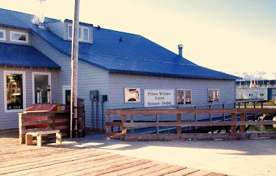

PWSSC site:
www.pwssc.org

To the north, tha main road (
Orca Road) takes to the
Ferry Terminal and terminates at the
Orca Adventure Lodge, a restored cannery for tourist fishing and flight-seeing trips.
 Night falls at the PWSSC
 Cordova at late evening
 The Alaskan Hotel, at 1st street, by night.
---------------------------------------------------
There are only two ways to get to Cordova: you can
fly or
take the ferry. There is a regular ferry service to
Whittier takink 3 to 7 hours to get across Prince Willians Sound.
 The new fast ferry Chenega at Cordova's terminal.
 The Aurora, serving the people of Cordova since 2005, takes 7 hours to cross the Prince Williams Sound's waters
Luckily there is also an airport with daily service to Anchorage.
 The "Mudhole" airport , as it is known
Merle "Mudhole" Smith
The "Mudhole" airport , as it is known
Merle "Mudhole" Smith was a bush pilot , one of that special breed of hearty individualists who overcame all the obstacles to make air transportation a reality in the remote reaches of Alaska in the early days.
The Copper River Delta

The
Copper River Delta is a large wetland territory of tidal and submerged lands in
Orca Inlet near the mouth of the
Copper River.

Its name comes for the abundant copper deposits along the course, but it also has prolific runs of wild salmon, which are among the most highly prized stocks in the world.
 Miles glacier also feeds the Copper River Delta.
It includes islands and mainland areas with extensive marsh adjacent to tidal channels. Numerous stream drainages and ponds are distributed east and south of the
Copper River Highway.

The wetlands on the delta provide a variety of shorebird nesting habitat.
 Fabulous landscape along the Copper River Highway, through the Copper River Delta
.

The Million Dollar bridge

The
Miles Glacier Bridge, also known as the
Million Dollar Bridge, was built in the early 1900s, across the Copper River, fifty miles northeast from Cordova. It was part of the Copper River railroad, built to transport copper from the old mining town up river (
Kennecott Mine) to the port of Cordova.
It is now a classified Historic building.
 The Bridge has been converted to motorcar traffic but it is unsafe.
This is also the end of the only road from Cordova, the
Copper River Highway, that was never continued to reach the road to
Whittier. The 48-mile highway terminates just after the
Million Dollar Bridge, at
Childs Glacier, and is in very bad shape - only the first 12 miles are paved. After heavy snowfall, it gets quite hard to drive on.

From the bridge you have a view of nearby
Childs glacier:

The map shows the 48-mile
Copper River Highway, through the river delta from Cordova to the Bridge:

The Childs Glacier, calving into
Copper River:
 7 miles wide, with a 300-foot-high face, Childs Glacier
 is certainly Alaska’s most spectacular roadside glacier – it’s the only one where you can see calving. And when the calving is active in high summer, you’ll see a major event every 15 minutes. Some of these collapsing icebergs are so large, they send a 10-foot wave rocketing across the river and crashing onto the opposite shore.
--------------------------------------------------------------

Ptarmigans enjoying the view to
Prince Williams Sound
---------------------------------------------------
Read more:
Frommer's destinations - Cordova
 Island of hell, scenery of shipwrecks and drama.
 Location : 74.30° N, 19.01° E


 Coordinates: 74°30'N 19°01'E
 The station consists of about 20 buildings in total, in an area of approximately 150 000 m2 .


